 vesseltracker.com
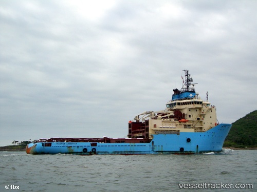
Vessel KARADENIZ POWERSHIP ALI BEY IMO: 9254379, MMSI: 636020113 Offshore Tug/Supply Ship
Live AIS position:
UTC. 366 nm NW of Amundsen-Scott),
updated 2025-11-25 22:07:56 UTC.
Find the position of the vessel KARADENIZ POWERSHIP ALI BEY on the map. The latter are known coordinates and path.
marine traffic ship tracker show on live map
The current position of vessel KARADENIZ POWERSHIP ALI BEY is -83.88914 lat / 79.03154 lng. Updated: 2025-11-25 22:07:56 UTCCurrently sailing under the flag of Liberia
KARADENIZ POWERSHIP ALI BEY built in 2004 year
Deadweight:
4597 tDetails:
Last coordinates of the vessel:
2025-11-25 22:07:56 UTC, -83.88914, 79.03154, course: 290, speed: 0